Tuesday, January 3, 2012
Time for an experiment


Wednesday, April 7, 2010
Bridalveil Falls Parking Lot... Your Average Gold Depository.

Monday, April 5, 2010
There's Great Geology Here, I Swear!


Although the drive from Turlock was nearly 210 miles, the distance goes quickly on I-5, making this National Monument a doable day trip if you leave early. We left at 9am and returned the same night at 9pm having had a full day to explore and photograph. Those who visit this area normally devoid of hominids, save for a few geologists or botanists, will find many treasures on display for a very limited showing.
Leaving the monument I would recommend taking HWY 58 West to Shell Creek Road and then taking that road north to Sheldon and HWY 41. Along the way you just may spy some more wild flowers growing amongst the Upper Miocene-aged (from what I can discern on old maps) layer of coquina that is the region's namesake.

Sunday, March 14, 2010
WildLink Club Visits Point Reyes National Seashore.

Fourteen Turlock High WildLink club members had an amazing day visiting Point Reyes Nation Seashore. While it seems entirely implausible that students growing up a mere two hour drive from the Pacific Ocean had never in their life seen the ocean or touched sand, it is a reality for many of our club members! To remedy the situation our club members got to experience many “firsts” by visiting Point Reyes National Seashore. It was the first time any of them had stood on an actual fault, the first time many of them had seen the ocean, the first time many of them had seen elk, the first time any of them got to run their toes through the sand, etc, etc.
The day was nearly perfect. Temperatures were in the mid fifties with nearly 30mph winds. But our reward for braving the wind was a crystal-clear day in which we could literally see for miles. We started the day by entering the park from S.F. which required a beautiful drive across the Bay & Golden Gate Bridges. We then stopped for a fun geology jaunt along the San Andreas Fault and its rupture zone from the 1906 earthquake. We then headed out to Pierce Point Ranch on Tomales Point for a birds-eye view of the azure Pacific while on a four mile hike. Along the way we got lucky and spied some large Tule Elk very close to the trail, but no whales out in the sea.
The last stop of the day was at the amazing Kehoe Beach. Not only was there good geology (seeing the Laird Sandstone, the Monterey formation and Salinian granitics) but there were also tons of freshly deposited jelly fish! Not to mention the tide was out and everyone got to get their feet a bit wet and sandy. A great day was had by all and it would have been better if the doggone clock hadn’t lost an hour on Sunday morning!
Monday, March 1, 2010
Jon Stewart Reads my Mind
And here's Sanchez's mia culpa in which he states he was a bit frustrated trying to understand a whole bunch of "scientific jargon". Oh boy... no redemption for Ol' Sanchez....
And, oh BTW, did anyone happen to stumble across the following tsunami video on Youtube? Great footage, but a bit risky for not knowing exactly what was coming, even if it was the second crest.
Sunday, February 28, 2010
Anchorperson Science Stupidity Award ~ Rick Sanchez's Tsunami Coverage: A Nine Meter Drop? What Does That Mean

With the entertainment awards season in full throttle I thought it would be nice to create an award that would recognize science achievement by the cable news media since they get so little love during events that have scientific significance or causation. However, after watching more than three hours of cable feeds this afternoon trying to see a tsunami (small as it may have been) roll ashore in Hawaii, I realized science achievement by an anchorperson was an unattainable dream.
So back to the drawing board to create a more meaningful award. My first incarnation, "Science Douche of the Week", had a good ring to it. But upon further review I was afraid folks like Glen Beck might steal the catchy name of this award and apply it to scientists who continue to "believe" in that confounded global warming stuff. I couldn't stand the thought of good scientists being labeled as douches or the thought of the word "douche" being uttered on air. So, back to the proverbial drawing board I went for the third time determined to create a great award.
After many seconds of deep, ponderous thought I had an epiphany... I specifically needed to include "anchorperson" and "science" in the title of the award so as not to confuse anyone. Thus I settled on the "Anchorperson Science Stupidity" award knowing it would be classy, specific, and the least likely award name to be ripped-off by news organizations. With that in mind, please let me introduce the inaugural winner of the "Anchorperson Science Stupidity" award.
The first Anchorperson Science Stupidity award in history now belongs to CNN's Rick Sanchez who was briefly interviewing poor Dr. Kurt Frankel from Georgia Tech. Thank god for online transcripts so that I can fully relay the exchange that made me want to jump through the TV and strangle the "Sensationalist Sanchez" and also cower in embarrassment all at the same time.
The scene of the award wining conversation: Meteorologist Ms. Jeras was using her fancy touchscreen to illustrate some recent readings of a 9m drop detected by buoys several hundred miles off the Hawaii Coast. An apparently confused Rick Sanchez then asked Jeras what a 9m drop meant? Deciding she didn't quite know, Jeras deflected the question to poor Dr Frankel. The intense interview that ensued is why Rick Sanchez wins the A.S.S. award... take a look.
JERAS: OK, so these are the detection which are out there in the Pacific Ocean. And you can see the flashing ones. These are active. These are the ones that we're watching. And there's Hawaii right from there. About 140 miles away from the Hawaiian island, we have a Bouie out there and this is what it is showing here. There you can see the line and notice this big drop down here. We have this big drop. This is about a nine-meter drop.
SANCHEZ: Nine meter drop. What does that mean?
JERAS: Well, it means that the ocean waves are doing something, that we're seeing some changes, it's been going down. And look at that, we've got a big rise. And so we're going to get our expert in here who's way smarter than you and me put together. Dr. Kurt Frankel.
And Dr. Frankel, tell us a little bit, you know, we talk about how the tsunami waves will come in or the water will pull back before we start to see. Is this a sign of that?
DR KURT FRANKEL, GEORGIA INST OF TECH: I think that's a sign of that. I don't think you can translate that nine meters into necessarily any specific wave height that will hit Hawaii, so we need to be careful about that. You know, doesn't necessarily mean it's going to be nine meters of run-up in Hawaii. But it's showing that the tsunami in fact...
SANCHEZ: Nine meters, by the way, nine meters in English is ...
FRANKEL: Oh, about 27 feet. SANCHEZ: Twenty-seven feet. So we're seeing a 27-foot drop in that area right there? Sorry about that.
FRANKEL: That's right, and so this is recorded by a pressure censor on the bottom of the ocean that is attached to a buoy. So that pressure sensor, the pressure of the ocean changes, as the wave comes through, it sends a signal to this buoy, which relays it to satellite and then down to NOAA.
SANCHEZ: Well, hold on a minute, wouldn't it follow that -- follow that if all of a sudden a part of the ocean just dropped 27 feet, the reaction to, you know, the yang is that yin is that it will also go up at some point?
FRANKEL: It will go up. But that does not mean, again, that there is not going to be 27 feet...
SANCHEZ: No, I'm not asking you to do 27 to 27. I'm just saying if there's a drop, will there be an increase?
FRANKEL: There should -- there should be an increase.
SANCHEZ: So there will be some kind of wave activity there. What you're saying is we can't exactly measure...
FRANKEL: You can't extrapolate that to what is going to happen in Hawaii. OK, it's the function of the coastline topography, of how the -- of the slope of the continental -- there's no continental shelf in Hawaii, but the slope of the land coming off the coast. And so, there is a whole other number of factors that play into this.
SANCHEZ: But what we can say is, tell me if I'm wrong, there is a tsunami there and it was just detected that it caused a 27-foot drop.
FRANKEL: Yeah, we recoded the tsunami passing that buoy, yes.
SANCHEZ: That's important. Sorry. Um, well, this is interesting. I mean, I have never seen something develop like this and science being used the way you guys use it to get all of your material
Monday, February 22, 2010
Time to break in the new D700 in Death Valley!

To see most of the trip stops in Google Earth, click here.
Monday, May 18, 2009
You light up my life

Tonight marks a special occasion for me. I actually checked-off one of my lifetime to-do's of capturing lightning on film (or sensor) and it was all because of a tip from a student. Turlock had an unusually humid evening tonight like something out of the midwest (dp was about 50f or so). Laura and I had noticed the unusual mammatus clouds forming above Turlock and commented on how strange of an occurance that was for this area during this time of year. We both knew the hills (sierra's) would be ripe for storms but thought little of it as we had other teachery chores to finish at home.
Then, a little after 9pm, a student of mine having, had the lightning lecture from several weeks back still fresh in her head, rang my house phone and told me that she was witnessing amazing lightning strikes in the direction of the southern sierra foothills. So I did what any good teacher would do; I dropped everything I was doing, got my camera and tripod and dragged Laura to the plowed fields east of town to take some pictures.
I had almost been killed trying to accomplish the task of capturing lightning in a bottle several years ago while in the White Mountains, and actually tried to take the pictures by pressing hte shutter when I saw the lightning... probably to most stupid thing I've ever done. To make a long story short, I knew that I now had to have a long exposure to capture the lightning, so I set-up my tripod along the canal bank, opened the shutter for 30 seconds and got lucky! Several follow-up shots should have been better but were out of focus! Oh well. I'll learn from my mistakes, and at least have one awesome shot to show my students tomorrow.
Monday, April 13, 2009
Mighty Grand Tetons


What a difference a day makes during the spring in Jackson Hole. Laura and I are crazy reverse commuters when it comes to spring break, choosing to shun the warmth of California for the cold of WHY?oming. Yesterday (first pic) we got to witness the 9myo Tetons in all their Easter glory. Folks from far and wide were utilizing the plowed inner-road of the park that is currently only open to bike & pedestrians.
Today (second pic), we got to see the Moody side of the range from the north side of the park (along with many moose, elk, coyotes and several bison). A storm front was pushing its way in producing billowing clouds and shadows that will make for some amazing b&w photos when I get a chance to tinker with them.
Friday, March 20, 2009
There's gold in them thar hills.
 Geotripper already beat me to the punch, but I've been thinking about posting this picture since returning from his southern Mother Lode trip. For some reason Garry always lets me drive the vans, and in return I get a glimpse into his vast wealth of geologic/anthropological information of our surrounding area. Not a bad trade-off if I do say so. Here's a link to the complete daytrip if anyone is interested in seeing all the sights we took-in.
Friday, March 13, 2009
Pink Friday -RIF

Today is Pink Frinday in California. Help show your support of public education by wearing pink today and voting for folks who value education. This year's budget mess has left many districts and universities no choice but to issue pink slip (Reduction in Force - RIF) notices to many highly qualified teachers, administrators and clerical staff. The opportunities taken away by such cuts ultimately affects the students and the future of California.
Above is my take onthis year's Pink Friday Logo - the old Turlock High Building which is now the district office.
Wednesday, March 11, 2009
Liquid Assets?

As I read this Op-Ed piece in the Modesto Bee on Monday, I got a bit frustrated. The editor clearly understood the plight of southern Central Valley farmers during the current & past droughts. But instead of asking for smarter crops or fallowing marginally productive lands, the paper was upset with lawmakers... and not for subsidizing bad farming techniques. The paper was dismayed that our lawmakers had not created new water storage systems over the past 30 years! Having extensively toured many of California's water projects (like the Delta-Mendota canal above), I am quite happy that there was no action during the past thirty years. The past projects have already done grave damage to the environment which is why I responded to the Op-Ed piece by writing a letter to the editor which follows below.
Perhaps a pertinent lesson in water resource management can be learned from the ongoing credit and mortgage meltdown.
During the recent central valley boom, the response to the population pressure was to build new “storage” for the valley residents in the form of sprawling, over-valued houses. Such houses were financed by short-sighted and unrealistic loans that would inevitably lead to the collapse of the local & national economies. The predictable aftermath of such unfeasible loans can be witnessed by the many dilapidated houses in neighborhoods and the unfortunate suffering of those who have lost their source of income.
Building new water storage facilities in response to increased demand is akin to taking a bad loan from the environment. Like so many mortgages, water diversions to saline-rich soils will never be repaid to the bank (ecosystem) from whence it came. The resultant collapse initiated by an overdrawn water loan will be devoid of any aesthetic, ecologic or financial wealth.
Unlike the mortgage tragedy, Californians have the power of prescience to prevent a looming environmental calamity. Residents of this great state should do their best to make their current water delivery & usage as smart, efficient and minimalistic as possible by choosing appropriate crops and auditing personal water consumption.
Wednesday, February 25, 2009
A letter to Bobby Jindal

Mr. Jindal,
I cordially invite you to join my
I was dismayed to have read your recent disparaging comments toward the stimulus money slated for volcanic observation and monitoring. As a an elected government official whose home state was devastated by a horrible & predictable natural disaster just three years ago, one would think a person such as yourself would be very interested in life-saving data that could be obtained through scientific monitoring. A USGS study has shown that a $1.5 million dollar investment to study Mt Pinatubo (
With many National Parks & metropolitan cities in the west situated near or on historically active volcanoes, it is imperative that the government do its best to inform its citizens of the risks associated with those areas, as well as provide a planned coordinated response in the event of an impending eruption. The $140 million slated for “something called volcano monitoring” will create many geology-related jobs to monitor, interpret and maintain data sources for the volcanic observatories. Geologists’ spending their income stimulates the economy just as much as any other professional’s spending.
My students will have a full understanding of the concepts I have just presented within a week. I hope the same time frame is applicable for your improved understanding of the benefits that are provided by the USGS Volcanic Observatories. If not, the invitation is always open to visit my classroom.
Sincerely,
Ryan J Hollister
Geosciences Educator
Monday, February 23, 2009
Smart-alec retort: Niagra's got nothin' on these...
 The waterfall meme planted a seed in my head when Outside the Interzone ranked Niagra Falls as the number one waterfall in North America. As a mature "neener-neener" to currently flowing falls, I offer some falls that dwarf Niagra 10-fold!. OK, ok, so maybe Niagra still has water, but this stiched photo show evidence for one of the most infamous "waterfalls" in North America. Any guesses as to the name of this place? I'll give you a hint: a one-time high school biology teacher helped turn the then accepted geologic definition of uniforminarianism on its head.
I'll give you one last clue with the photo below. Good Luck!

Sunday, February 22, 2009
I fall for Waterfalls
Like most folks, I too love waterfalls and wanted to share some pretty ones even though I haven't been to many on the list below.
Here are a few of my favorites:
 Johnston Falls, Banff NP, Alberta, CA
A favorite from my honeymoon 3 years ago. The catwalk to get to these falls was something else too.
 Chilnualna Cascades, Yosemite
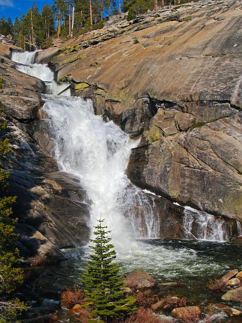
For my money, the best waterfalls/cascades in the entire park. It's a non-stop butt-kicking 4.25 mile, 2800' grind to get to the top, but well worth the effort. The main falls and cascades roar in the spring run-off. The fishing is quite good too! Here's my main photo album of Chilnualna Creek Hike
 Mystery Falls? Near Silverton, Colorado
These falls just outside Silverton were tumbling next to Paleozoic ripple marks. Beyond the beauty of the falls themselves, I thought the juxtaposition of old and new made this one of the most special falls I've ever laid eyes upon. The scale is hard to ascertain, but this drop is well over 300 feet.
Saturday, December 13, 2008
Where in the World??

If you haven't quite noticed yet from the few entries I've had in this blog, Geotripper and my wife have played extremely important geologic roles during my formative years of young adulthood. My wife, has been a rock of support for me and an excellent adventurous spirit that enjoys exploring North America as much as me. Geotripper... well he was the glint in my life that can best be likened to a partially visible topaz face mostly buried in rhyolite in the middle of Utah. He, like the topaz, spurred a desire in me to dig deeper and uncover the beauty and stories trapped within the geology of the American west. Because of Dinochic and Geotripper, ( and very caring parents that exposed me to many roadtrips as a child) I can embolden many of the following categories within Geotrippers meme of 100 things I've done. It looks to be 53, or so of those things, as a matter of fact. Not bad for 30 years of existence! I'm just happy to have most of the experiences on "film". I've tried adding my photographic evidence to as many experiences as possible. I hope you enjoy.
1. See an erupting volcano
2. See a glacier
3. See an active geyser such as those in Yellowstone
5. Observe (from a safe distance) a river whose discharge is above bankful stage (I'll have to dig for the film of the '97 Tuolumne & San Joaquin floods)
6. Explore a limestone cave. Try Carlsbad Caverns in New Mexico, Lehman Caves in Great Basin National Park, or the caves of Kentucky or TAG (Tennessee, Alabama, and Georgia)

8. Explore a subsurface mine.
9. See an ophiolite, (still looking for pics)
11. A slot canyon (it'll have to do until I can find childhood pics). Many of these amazing canyons are less than 3 feet wide and over 100 feet deep. They reside on the Colorado Plateau. Among the best are Antelope Canyon, Brimstone Canyon, Spooky Gulch and the Round Valley Draw.

13. An exfoliation dome, such as those in the Sierra Nevada.
14. A layered igneous intrusion, such as the Stillwater complex in Montana (and look what's around my neck... sigh.
16. A gingko tree, which is the lone survivor of an ancient group of softwoods that covered much of the Northern Hemisphere in the Mesozoic. We have an amazingly old gingko at Turlock High, and I always take my students out observe to its beauty, and then make leaf rubbings to compare to a gingko fossil. These pics are a bit blurry. Sorry.
18. A field of glacial erratics
19. A caldera (it's not Yellowstone!)
20. A sand dune more than 200 feet high (camera was stowed as to not get sand in it)
22. A recently formed fault scarp (I know I have the pic somewhere!!!)
23. A megabreccia
25. A natural bridge
27. A glacial outwash plain (photos to come)
28. A sea stack (photos to come)
29. A house-sized glacial erratic
30. An underground lake or river
31. The continental divide
32. Fluorescent and phosphorescent minerals
33. Petrified trees
34. Lava tubes (I think you'll like this pic)
35. The Grand Canyon. All the way down. And back (I haven't gone up & down yet... someday when I'm not the driver for the trip)
39. The Waterpocket Fold, Utah, to see well exposed folds on a massive scale (No ariel pics yet).
44. Devil's Tower, northeastern Wyoming, to see a classic example of columnar jointing (I was an infant the last time here)
50. The Goosenecks of the San Juan River, Utah, an impressive series of entrenched meanders.
51. Shiprock, New Mexico, to see a large volcanic neck
54. Mount St. Helens, Washington, to see the results of recent explosive volcanism.
59. The Mima Mounds near Olympia, Washington
62. Yosemite Valley
63. Landscape Arch (or Delicate Arch) in Utah
65. The Channeled Scablands of central Washington
66. Bryce Canyon
67. Grand Prismatic Spring at Yellowstone (hmmm, where did these pics wander off too?)
68. Monument Valley
69. The San Andreas fault
74. Denali (an orogeny in progress) (need to scan old pics from '92)
76. The giant crossbeds visible at Zion National Park
77. The black sand beaches in Hawaii (or the green sand-olivine beaches)
79. Hells Canyon in Idaho
80. The Black Canyon of the Gunnison in Colorado
82. Feel an earthquake with a magnitude greater than 5.0
84. Find a trilobite (it's my wife at a great collecting spot)
85. Find gold, however small the flake
90. Witness a total solar eclipse
93. View Saturn and its moons through a respectable telescope.
95. View a great naked-eye comet, an opportunity which occurs only a few times per century
96. See a lunar eclipse
97. View a distant galaxy through a large telescope
Tuesday, December 9, 2008
Whoa! I knew my wife would test me... but on a real test?

Apparently the universe has just sent several messages to me all wrapped-up in one drop-your jaw, amazingly crazy story of my wife (above in Death Valley, 2005) testing me... and I mean this literally. She actually appeared on a test I just took. Not a mere apparition like Jesus on toast. Not an apparition at all. This was a real angelic infiltration that had been conjured four years ago by an amazing geologist, photographer, storyteller and apparent sorcerer, Geotripper.

In future posts I'll have to tell the story of how Laura and I met on one of Geotripper's summer field studies, how we still help Geotripper in whatever ways we can to make his roadtrip life easier , and how he gave gave us the best wedding present ever. But for now those stories will have to remain as yet untold prequels to the amazing moment of my wife testing me.

Tonight was the culmination of my first semester of graduate studies in Geoscience Education through a distance learning program at Mississippi State. Just like all distance learning programs, the lessons are taught via DVD (or podcast for the even younger generation... apparently I'm already a techno-hasbeen at 30). Quizes and test for this course are administered online and must be completed during a given amount of time. No biggie, other than the fact that when one has a polite disagreement with a professor's test questions and answer rationale, it can be a bit hard to muddle through email correspondence to make sure everyone is on the same page.
My professor knew not of my background and extensive geologic travels with Geotripper, nor that I was married to a field geologist-turned great high school teacher. So imagine my immense surprise when up popped Question #~~ on tonight's semester final: "What type of fault is shown below?"
The question didn't throw me for a loop (this is the stuff 2nd graders learn), but the accompanying photo did. There, on my semester final, administered through
I hurriedly ran upstairs and dragged my recently tucked-into-bed & tired wife downstairs so she could witness her celebrity which you can view below. I only allowed her 15 seconds of fame because I only had twenty-nine minutes and 47 seconds remaining to complete twenty more questions. Laura relinquished a tired, bemused smile, groaned “I’m famous” and promptly went right back to bed.

Monday, November 17, 2008
A little help for my friends.

Turlock High WildLink 2008 atop Mt Hoffman, Yosemite.
The WildLink program is an amazing collaborative effort between the Yosemite Institute, Sierra Conservancy and others that brings students from "undeserved" demographics to Yosemite & Sequoia National Parks for a week-long experience free of charge. In return the students must participate in several wilderness stewardship projects throughout the year.
While experiencing WildLink, participants spend several days learning wilderness ethics and the value of wilderness at (ironically) Curry Village . The week culminates with a guided four-day backpacking expedition through wilderness lands. This year the trek started at Tuolumne Meadows and ended with an ascent of Mt Hoffman and exited at May Lake.
The challenges of a twenty-five mile hike with a full pack is daunting in and of itself. But for the THS WildLink students it's an even greater challenge when one considers 85% of the participants have never set foot in the Sierras, a mere 65 miles from where they live. Mind you, these are mountains that they can clearly see looming large on the horizon on many post-storm, clear winter days. If they maneuver to the correct vantage point just outside of Turlock's city limits they can see directly up Yosemite Valley to the tops of El Cap and Half Dome!
Needless to say the experience WildLink provides is usually life-changing for all those involved. Every bit of food, shelter and warm clothing is provided by the WildLink program for the duration of the week. The only cost to Turlock High is the transportation to Yosemite and a substitute teacher to cover my classes while I'm chaperoning the first several nights in Curry Village. In order to help add some funds to our coffer in this horrible time of educational budget cuts, the THS WildLink club has developed a 12 month Sierra Scenery 2009 Calendar to sell as a fundraiser.
The photos in the calendar were all taken by yours truly and represent 12 beautiful places the Sierras have to offer after a leisurely day-hike. Surprisingly few Californians have every seen these places in person! If you enjoy pretty pictures of a pretty place, maybe you'll consider donating $20 (costs $13 to print) to the THS WildLink club in return for great calendar. If interested, please click on the photo below which will take you to the "official" 2009 Sierra Scenes 2009 calendar. Thanks for looking!

Friday, October 31, 2008
Manteca's only bright spot...

Here is my submission for Geotripper's rainbow meme. My wife and I (who coincidentally met on one of Geotripper's field trips) happened to be out and about Lathrop during the heavy rains of April 2006. This photo was the lone bright spot of the afternoon.
We had been documenting for our students the foolish houses being built 60 yards from the San Joaquin River levee near Moss Landing. The same Moss Landing that flooded to a depth of eight feet in 1950. Deep down we were hoping for a small levee breach would wipe out the new house frames before anyone moved-in, saving a lot of folks some hardship down the road. As it turns out, foreclosures in the area have since left many houses abandoned which may be a serendipitous occurrence should a huge flood hit in the near future.
At one point we even saw a double rainbow (see below). Maybe this photo will make the folks at City Hall happy when the next flood hits (The Lathrop City Hall is new, and only several hundred yards from the levee).

Friday, October 24, 2008
A Honeymoon Metaphor?

 Responding to MJCRocks' call for photos of memorable trees, I have posted the picture of an amazing cypress tree my wife and I saw on our honeymoon in Olympic National Park. The tree stood strong, even in the face of trying times. Whenever I think back to seeing this tree in person, I can't help but remember thinking how great of a metaphor this tree was for the married life. Stand strong, even in trying times, and you will be rewarded with a life that is large, fulfilling and well-balanced.